
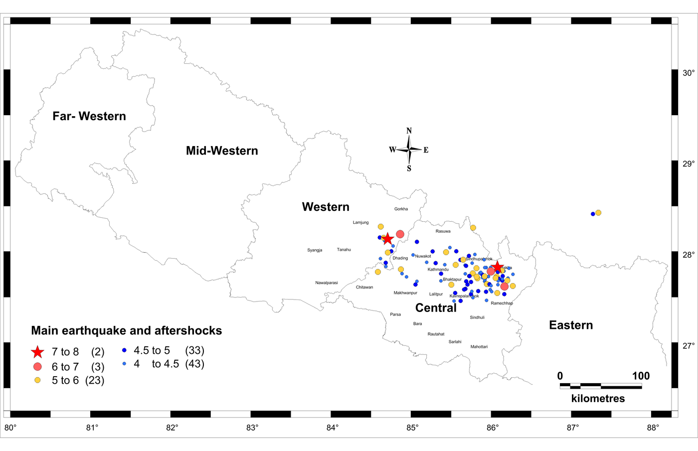
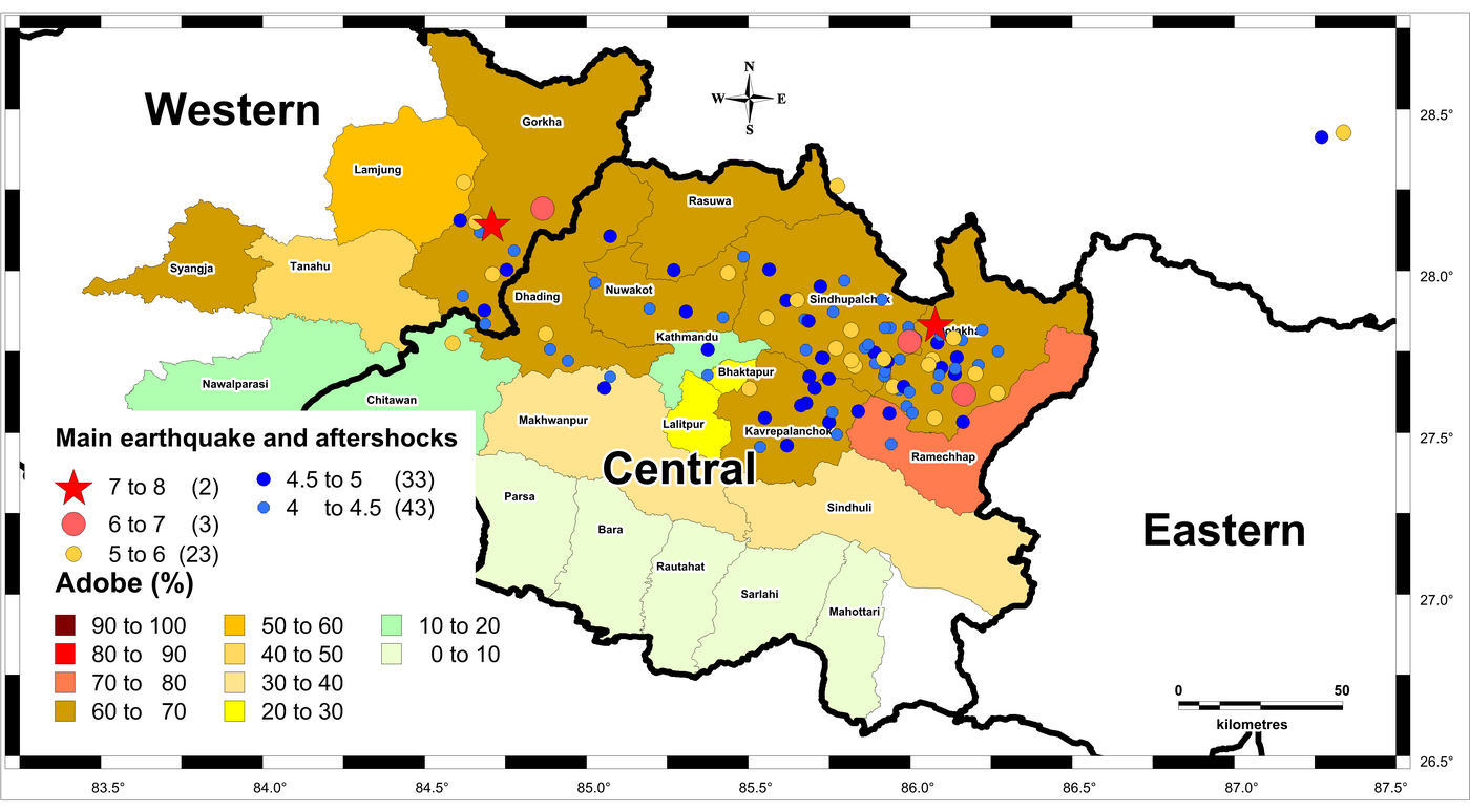
A magnitude M 7.8 earthquake struck in Western region of Nepal (Gorkha district), on 25th April 2015, with the epicenter 80 km North-West of Kathmandu (USGS, 2015a). There are five development regions in Nepal (see Figure 1). The main earthquake and aftershocks are concentrated mainly in the central region. The focus, in this report, will be only on the area affected by the 2015 Gorkha earthquake.
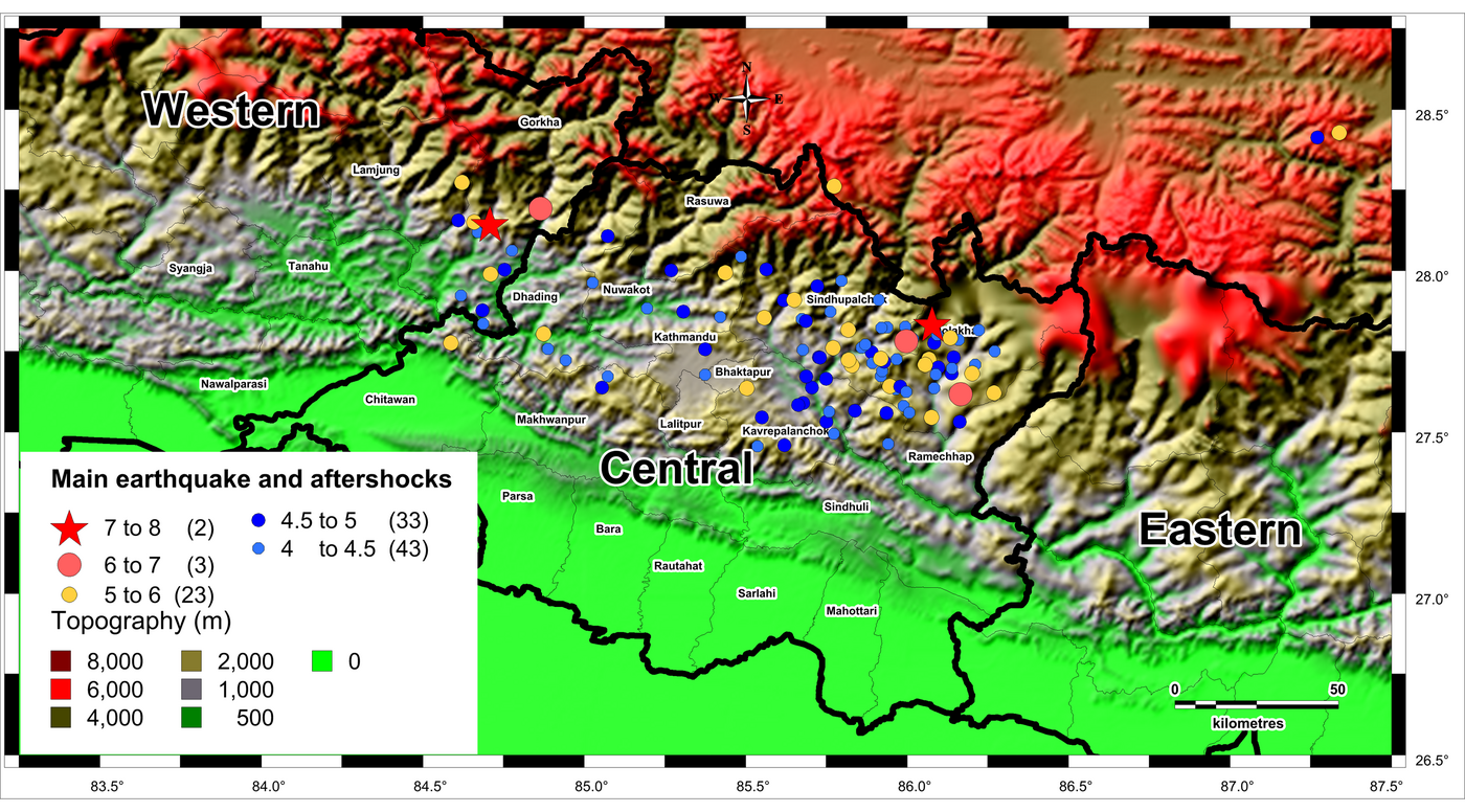
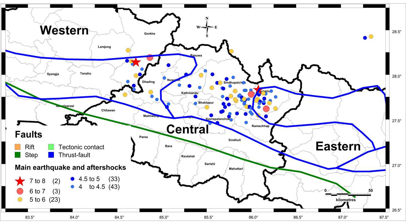
The terrain in the epicentral region is mountainous with topography ranging from 2000 to 6000m above sea level (see Figure 2). Therefore, it was difficult, in the early days after the earthquake, to access the area. There are many faults in the central region of Nepal (the most affected region) near the epicenter and all the aftershocks (see Figure 3)
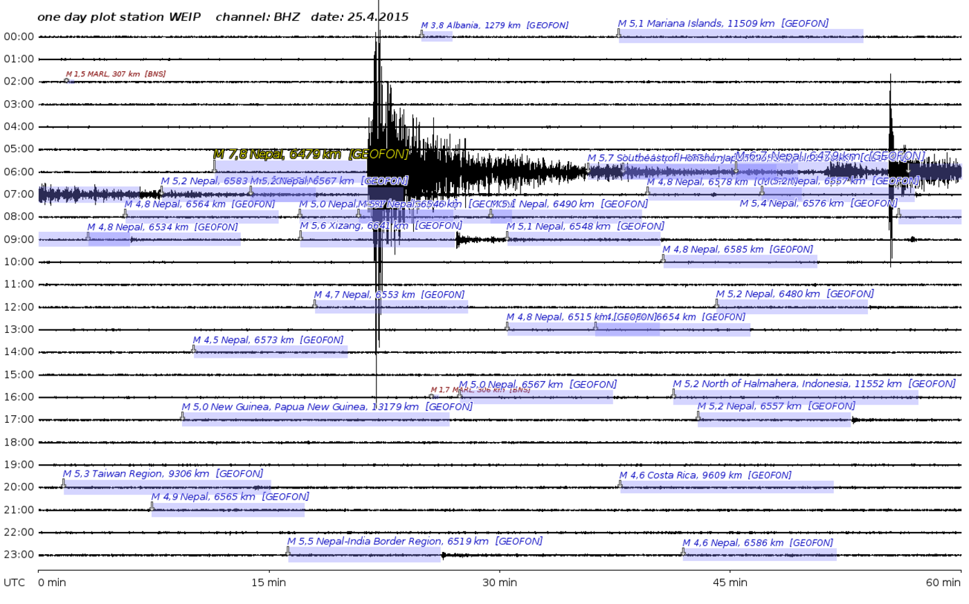
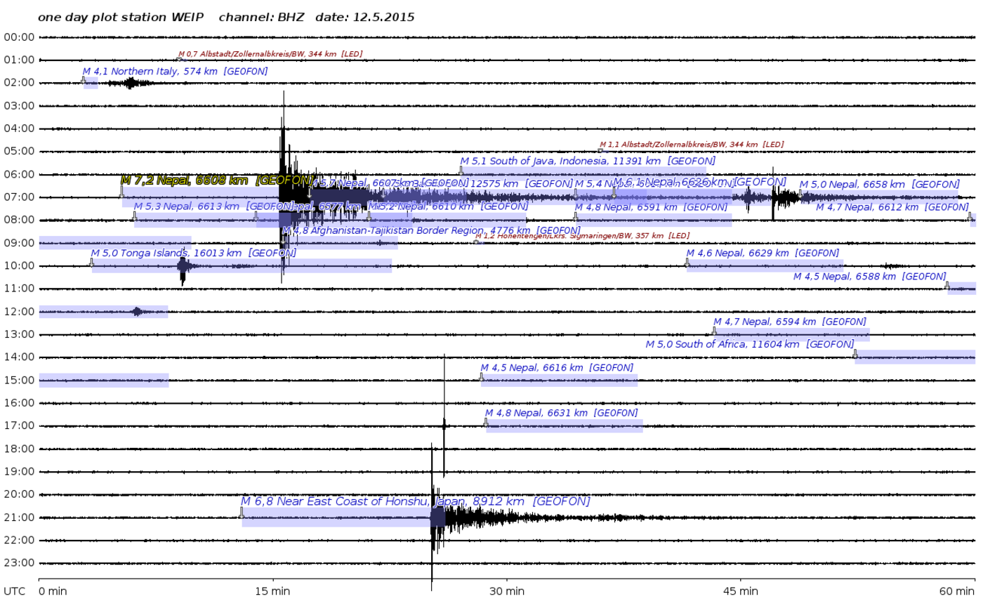
Historically there have been big earthquakes along these fault lines, among those was an earthquake on 26th August 1833 near to Kathmandu. Estimate of the moment magnitude of that earthquake based on reported intensities indicate that the earthquake was of 7.5 < M < 7.9 (Bilham, 1995). Another massive earthquake of M8.0 struck eastern region of Nepal on 15th January 1934. That earthquake caused more than 10,000 casualties. A return period of almost 100 years between the last two major earthquakes highlighted the probability of occurrence of a next major earthquake in about 100 years (the recent earthquake came after almost 81 years of the 1934 earthquake. The heavy tremors were registered at the seismic station in Weimar Parkhöhle (see Figure 4 and 5).
The distribution of building types of a country can be estimated based on the national census data. The available data from the national census is in terms of material used in walls and roofs. This data is transformed into building types, using different combinations of wall and roof materials (see Maqsood and Schwarz, 2008a; and Siddique and Schwarz, 2014). Similar methodology is used to develop typical building types of India based on the 2011 census (Siddique, 2015).
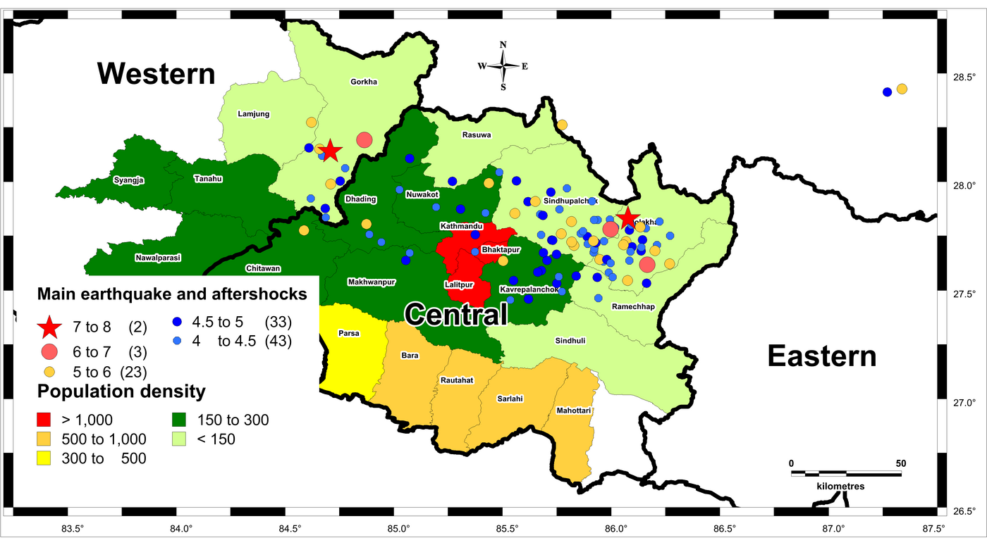
There was a recent census carried out in Nepal in 2011. According to the census there are 5,423,297 individual households in Nepal (GoN, 2012). The data is available at district level in terms of material of foundations, walls and roof. The available data is transformed into building types of Nepal. The typical building types are: adobe, brick masonry, reinforced concrete, stone masonry, timber and others. The distribution of building types indicate that the main earthquake as well as the aftershocks are located in the districts dominated by adobe and stone masonry buildings (see Figure 6 and 7).
Maqsood and Schwarz (2008b) proposed Mean Vulnerability Index (MVI) for building stock of Pakistan, based on European Macroseismic Scale EMS-98. For calculating the MVI, a number from 1 to 6 was assigned for each vulnerability class from A to F, and then taking the mean over the different percentages of each vulnerability class, the mean vulnerability index for a certain building stock was obtained. The similar concept is used here to calculate the MVI, at district level, for the affected districts in Nepal (see Figure 8). The districts hit by main earthquake and aftershocks are highly vulnerable against earthquake. The vulnerability class of buildings in those districts ranges from A to B (according to EMS-98, Grünthal et al. 1998).
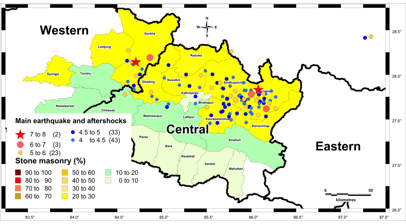
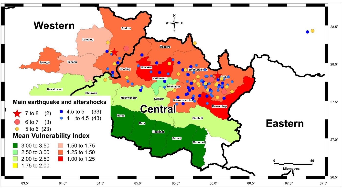
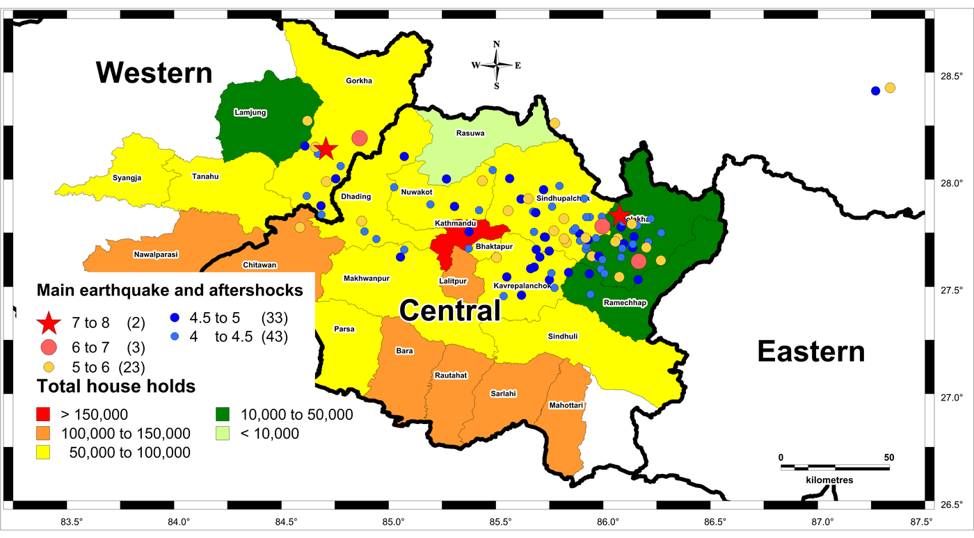
Figure 9 shows the population density map of the affected area of Nepal. The three central districts of the Kathmandu valley (Kathmandu, Lalitpur and Bhaktapur) have the largest population density. Whereas, in mountainous regions the population density is low. The main earthquake and most of the aftershocks are situated in the low population density region, but, some of the aftershocks are near to the districts having highest population density (see Figure 9). The total number of buildings in most of the affected districts is between 50,000 to 100,000 (see Figure 10).
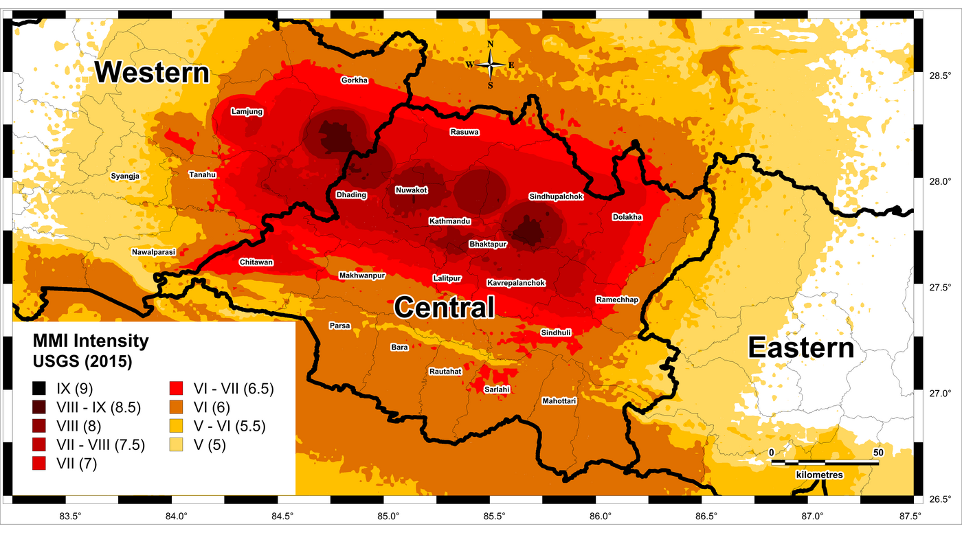
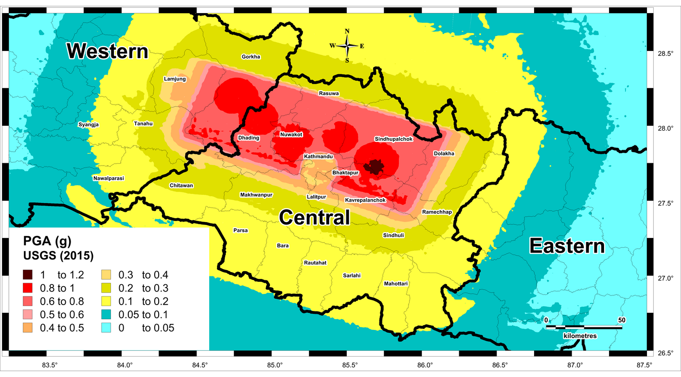
USGS has prepared the ShakeMaps for the 2015 Gorkha earthquake. The maps are represented in the form of Modified Mercalli Intensity (MMI) and Peak Ground Acceleration (PGA) (see Figure 11 and 12 respectively). According to the MMI map the maximum predicted intensity is VIII–IX in some parts of Gorkha and Sindhupalchok districts. The MMI intensity of VIII-IX can be regarded as intensity VIII (heavily damaging) according to EMS-98. Many buildings of vulnerability class A suffer damage grade 4; a few of grade 5 (EMS-98). A large number of aftershocks (including some of them, having magnitude greater than 6, as major earthquakes in themselves) have caused the already damaged buildings to collapse. The expected PGA map indicates a very high PGA value of 0.8 – 1.0 g in much of the affected districts (including 1.0 – 1.2g in some parts of Sindhupalchok district). The existing building stock is not capable of withstanding such strong ground motion and susceptible to heavy damage and collapse.
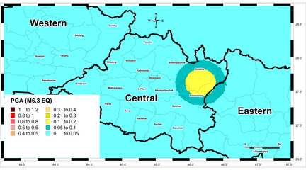
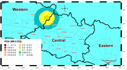
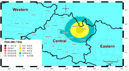
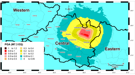
The Peak Ground Acceleration (PGA) maps, according to USGS, of four major aftershocks are shown in Figure 13. It is visible that the north-eastern part of central region is repeatedly affected by earthquakes. The expected damages are high in that part of Nepal.
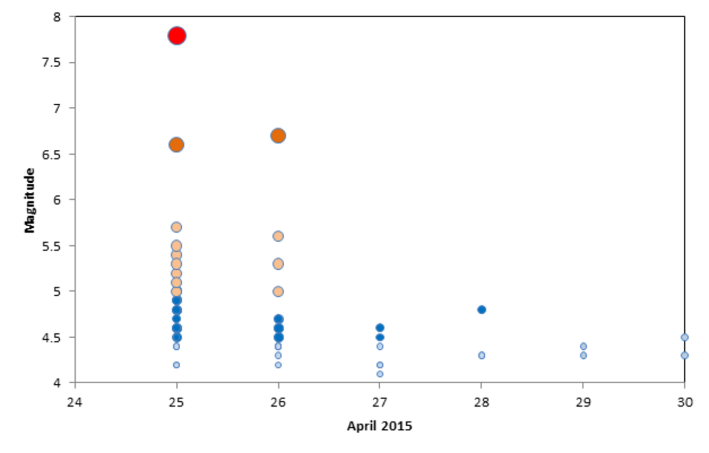
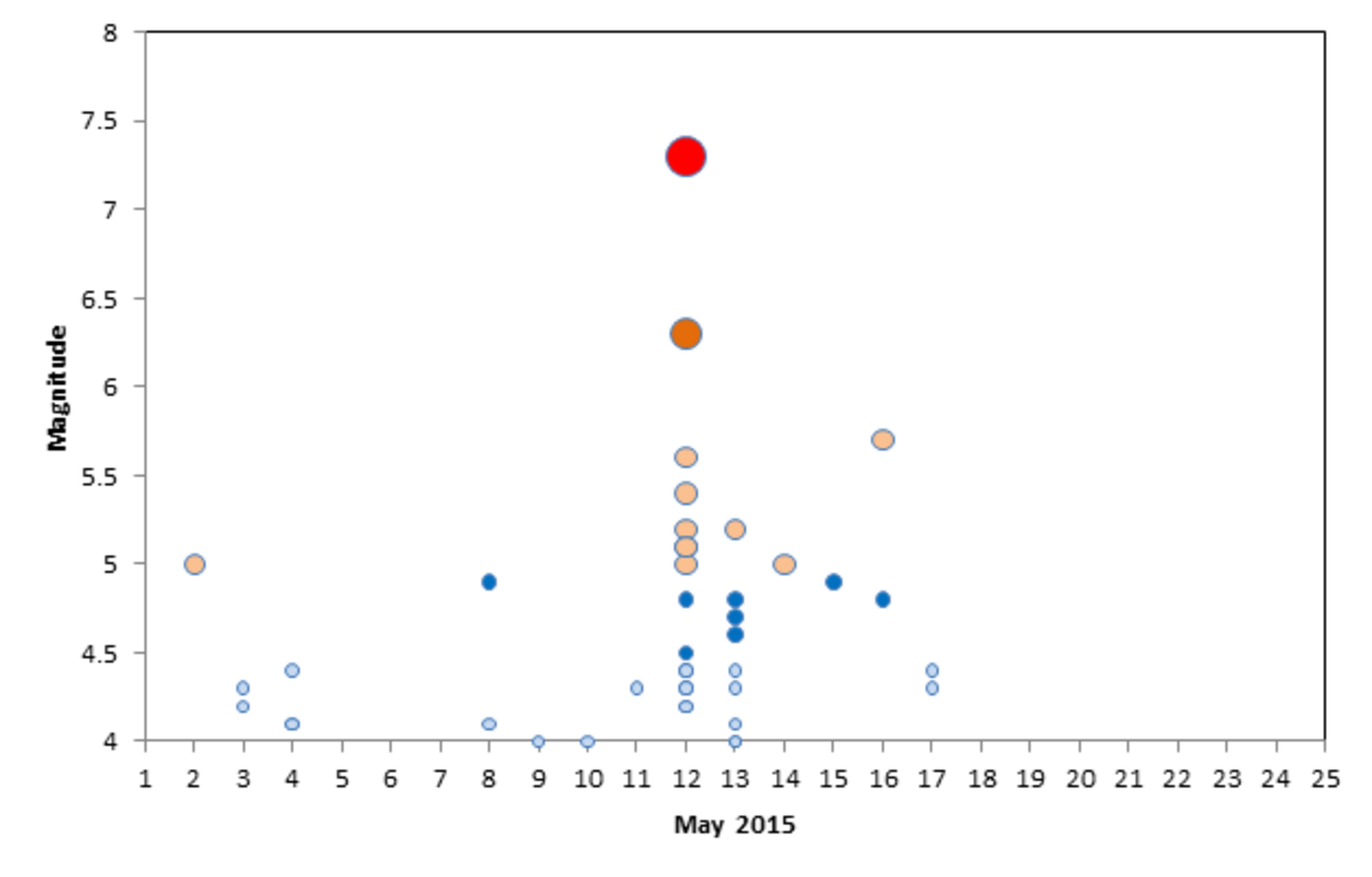
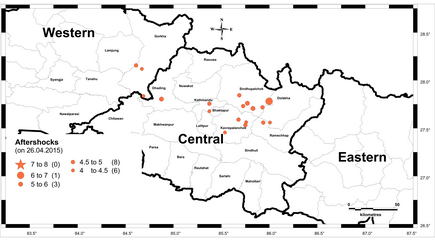
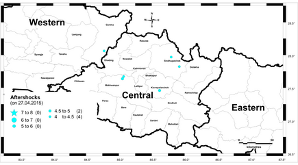
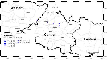
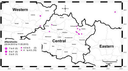
There are more than 100 aftershocks (until 17th May 2015) of magnitude greater than M4 (including 27 of them more than M5) after the main earthquake on 25th April 2015. The sequence of aftershocks on daily basis (according to local time zone) is shown in Figure 14 and 15. A considerable drop in the number of earthquakes as well as the magnitude of earthquakes was realized after 2 days of the main earthquake. But, on 12th May 2015 there was a very big aftershock of magnitude M7.3 and the number of earthquakes again increases for a couple of days.
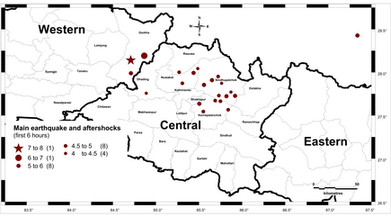
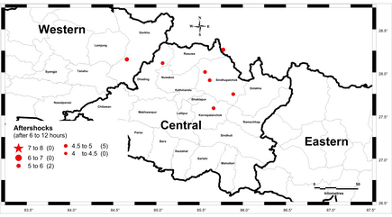
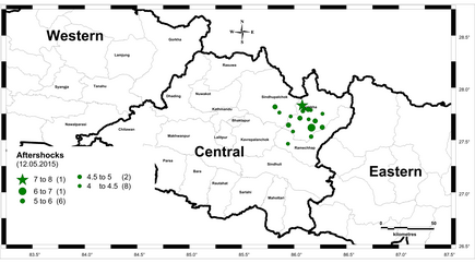
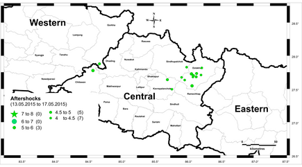
The epicenters and magnitude of all the aftershocks in different time intervals after the main earthquake are presented in Figure 16. It is visible in that the epicenters of the earthquakes have a shift in the north-east direction, with some districts being repeatedly affected by the aftershocks (e.g. Sindhupalchok and Dolakha districts).
References
Becker, J. J.; Sandwell, D. T.; Smith, W. H. F.; Braud, J.; Binder, B.; Depner, J.; Fabre, D.; Factor, J.; Ingalls, S.; Kim, S.-H.; Ladner, R.; Marks, K.; Nelson, S.; Pharaoh, A.; Trimmer, R.; von Rosenberg, J.; Wallace, G.; Weatherall, P. (2009): Global Bathymetry and Elevation Data at 30 Arc Seconds Resolution: SRTM30_PLUS. I: Marine Geodesy, 32 (2009) 4, S. 355–371, doi:10.1080/01490410903297766, . – SRTM30 Plus V6.0 data files.
Bilham, R. (1995). Location and magnitude of the 1833 Nepal earthquake and its relation to the rupture zones of contiguous great Himalayan earthquakes. Current Science, 69, 2, 25 July 1995.
gadm.org (2012): Global Administrative Areas., Karte, . – Version 2.0. [online] gadm.org/download_country.html (Last access 17.05.2015).
Grünthal, G. (ed.).; Musson, R. M. W.; Schwarz, J.; and Stucchi, M. (1998). Cahiers du Centre Européen de Géodynamique et de Séismologie: Volume 15 – European Macroseismic Scale 1998. European Center for Geodynamics and Seismology, Luxembourg.
GoN (2012). Government of Nepal, National Planning Commission Secretariat, Central Bureau of Statistics, Kathmandu, Nepal, November, 2012.
Maqsood, S.T.; Schwarz, J. (2008a). Seismic vulnerability of existing building stock in Pakistan. Proceedings of the 14th World Conference on Earthquake Engineering, Beijing, China. Paper No. 09-01-122.
Maqsood, S. T.; Schwarz, J. (2008): Analysis of Building Damage during the 8 October 2005 Earthquake in Pakistan. In: Seismological Research Letters, 79 (2008) 2, 163–177, doi:10.1785/gssrl.79.2.163.
Siddique, M.S.; Schwarz, J. (2012). Multi-hazard approach to assess vulnerability of the building stock in Pakistan. Proceedings of the 15th World Conference Earthquake Engineering, Lisbon, Portugal, Paper No. 1152.
Siddique, M. S.; Schwarz, J. (2014). Elaboration of Multi-Hazard zoning and qualitative risk maps of Pakistan. Submitted to Earthquake Spectra. doi.org/10.1193/042913EQS114M.
Siddique, M.S. (2015). Multi-hazard based risk assessment procedures. Case study: Pakistan. Forthcoming PhD dissertation, Bauhaus-Universität Weimar (submitted, under review process).
USGS (2009): Global GIS Databases - Datasets. [online] webgis.wr.usgs.gov/globalgis/datasets.htm (last access 04.03.2010)
USGS (2015a). M7.8 – 34km ESE of Lamjung, Nepal earthquake. earthquake.usgs.gov/earthquakes/eventpage/us20002926#impact_shakemap (last accessed 19.05.2015, map version 7)
USGS (2015b). Database: Search earthquake archives. [online] earthquake.usgs.gov/earthquakes/search (last access 17.05.2015)